Home
Project Info
About Me
Blog
Project Info
Project Description
Develop an application that links photos to a map.
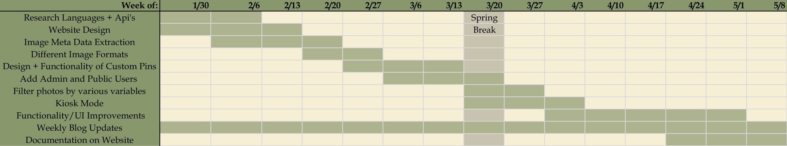
Timeline
Project Scope
Handle various photo formats.
Custom pins as thumbnails (or creating a legend that links numbered pins to thumbnails).
Choosing a pin/photo should enlarge the photo and show relevant meta data.
Determine how to represent multiple photos taken at or near the same location, taking into consideration the current level of zoom.
A zoom option will enlarge/shrink a region of the user’s choice.
Allow the user to choose a location on the map to collect all photos taken within N miles of that location.
The CS discipline will maintain the data to be displayed. They may need to add, delete, or modify data.
Discuss with others what data is to be stored behind the application to learn ways in which they might use the data.
A user of the application should be able to filter what locations they wish to see based on region, time, relevance, etc.
A zoom option will enlarge a region of the user’s choice, or occasionally zoom regions randomly so the map doesn’t look stagnant.
Documentation
Zipped Source Code
User Guide
Developer Guide
Presentation